Machine Learning Strategy
Vision
Reimagine your business, process, or website as a constantly learning system.
Strategy
Discover the technology, relationships, and concepts to unlock the power of machine learning.
Implementation
Devise specific program actions and technology integrations to implement a machine learning system.
Design
Ensuring that every node and integration contributes to a digital nervous system.
Zwerb is a software and design strategy company with an emphasis on machine learning, data platforms, and IoT.
Zwerb Core Service
Independently Owned
Zwerb is an independently owned company with an emphasis on best-of-breed technology strategy.
Network
We have an extensive and growing network and research capability, with a daily refresh rate.
Strategy and Implementation
We offer both strategy and implementation support. Including design, program, and project management.
Machine Learning
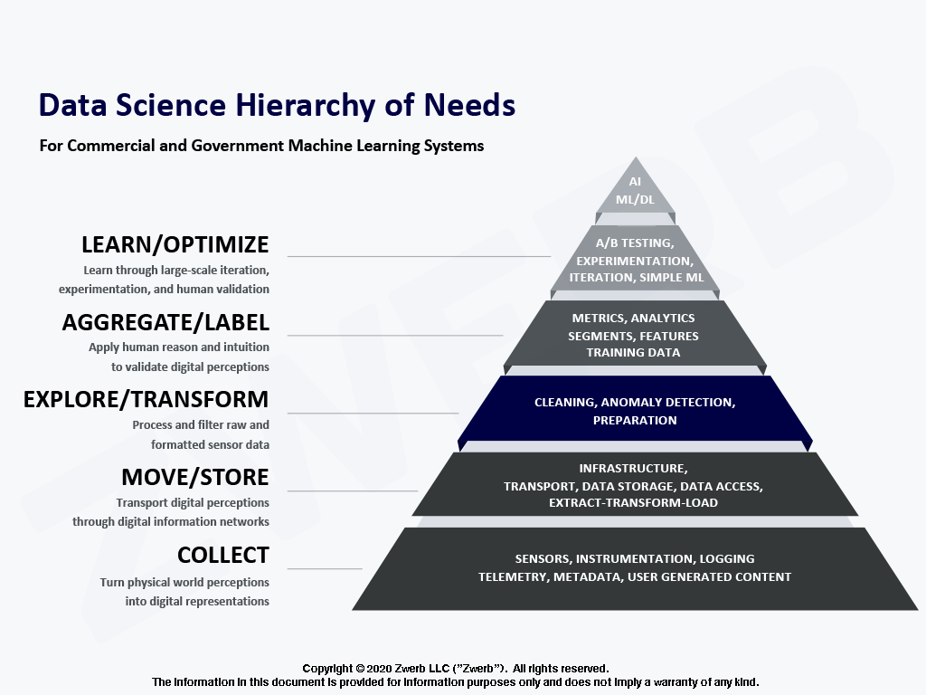
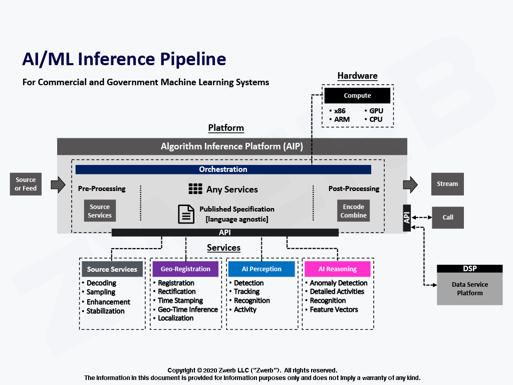
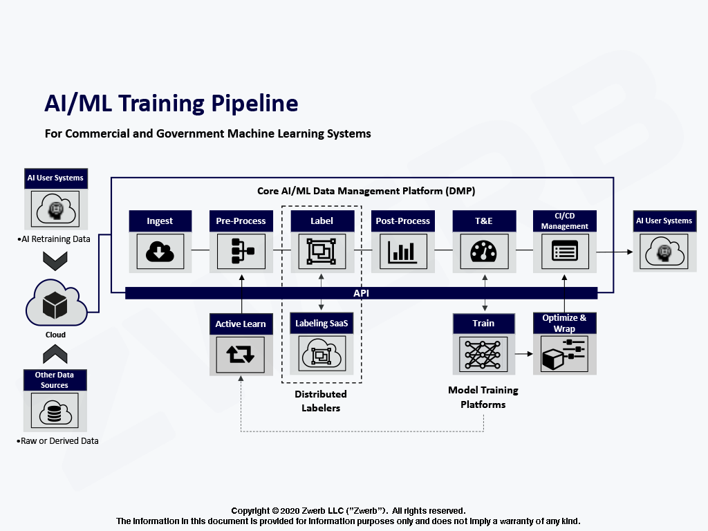
Machine Learning is a design concept and a software practice that turns the physical world into a learning system.
IoT
The Internet of Things (IoT) is a digital network of sensors and processors that represent a biological nervous system.
Data Platforms
All machine learning initiatives start with an idea for a desired output. Enterprise ML systems use powerful data systems.
Machine Learning integration is one discussion away.
Book a Strategy Session Now


